

WE ARE HERE!
WE ARE HERE!
"ENSURING QUALITY IS PRIORITY"
WE ARE HERE!
SERVICES

Hydrographic Survey
Bathymetric mapping is the mapping of water depths measured against vertical datum expressed in numbers or depth contours. The resulting map displays bas-relief with contour lines complemented by surface navigation information.

Topographic Survey
Topographic survey or mapping is also known as a measurement technique to determine a position or sign that occurs naturally or man-made above the ground. In this measurement, a data recording will be carried out using the instruments needed to draw a topographic map.

GNSS Survey
GNSS survey is a measurement technique using GPS to determine a position. GPS is a satellite navigation system that provides location and time information anywhere on the earth's surface on the condition that it still receives a GPS signal. The electromagnetic signal emitted by GPS is received by the receiver to be processed into position information.

3D Modelling
3D modeling is the process of creating 3D objects that you want to express in a real visual form, either in the shape, texture, or size of the object. The data that can be formed by a three-dimensional model are several overlapping photos that are produced from different shooting positions. This model is represented by three-dimensional points (x, y, z).
.png)
WebGIS Creation
Web-GIS is a web-based GIS (Geographic Information System ) which consists of several interrelated components. Web-GIS is a combination of mapping graphic design, digital maps with geographic analysis, computer programming, and a database that is connected to one part of web design and web mapping.

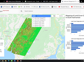
Photogrammetry Survey
Photogrammetry is an art and science that is used to obtain land coordinates (X, Y, Z) using aerial photography media. Airborne photogrammetry surveys are mainly used to map large areas with a relatively short period of time.

Establish professional cooperation and build trust in customers by maintaining data quality and the best service
ABOUT
PT. Avaro Geo Survey is a company engaged in surveying and mapping owned by Indonesian citizens and domiciled in Surabaya City, East Java. Our services such as topographic surveys, photogrammetry, hydrographic surveys, remote sensing, and geographic information systems.
VISION
Establish professional cooperation and build trust in customers by maintaining data quality and the best service
MISSION
-
Provide proffesional and reliable survey mapping services
-
Provide mapping survey services in accordance with customer need
-
Provide accurate and quality data survey
PROJECTS


CONTACT
Inquiries
For any inquiries, questions or commendations, please call our contact person or fill out the following form
Contact Us
Head Office
Keputih 3C Street / 66, Sukolilo Regency, Surabaya City
avarogeosurvey.wixsite.com/avarogeosurvey
Email : avaro.geosurvey@gmail.com
Facebook : AVARO Geo Survey
Twitter : @AVAROGeoSurvey
Instagram : @AVAROGeoSurvey
Employment
To apply for a job with AVARO Geo Survey, please send a cover letter together with your C.V. to: avaro.geosurvey@gmail.com
Contact Person :
+6285 777 867 840 (Adinda)
+6281 336 744 844 (Vandi)
+6285 736 381 770 (Rosma)